
How to Plan a Trek Using an Atlas Mountains Map
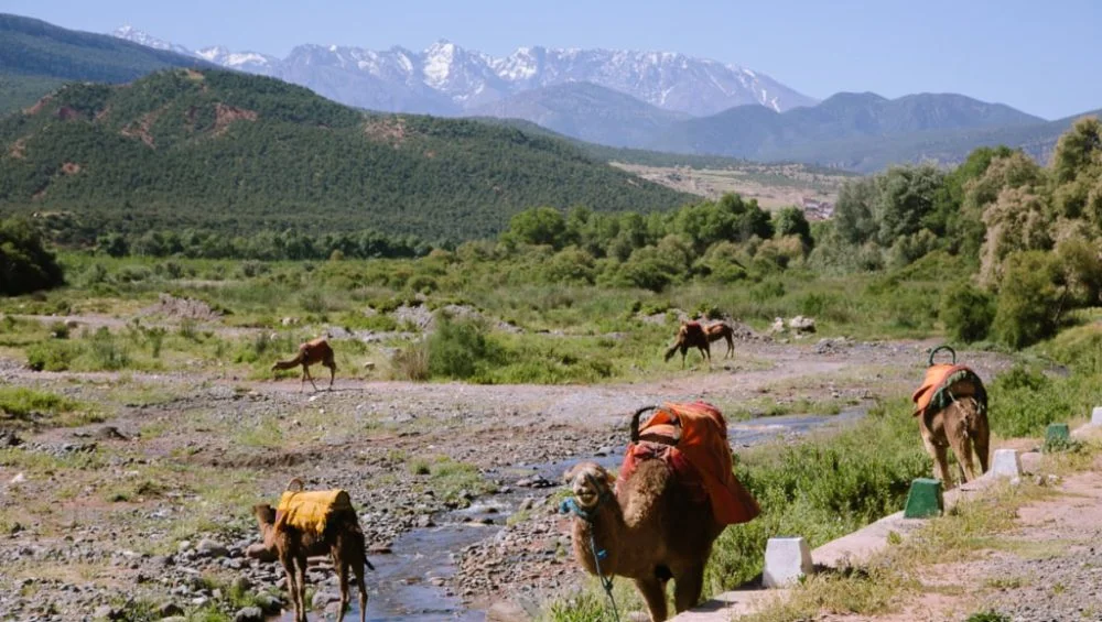
Trekking through Morocco’s magnificent mountain landscapes is an unforgettable experience for adventure lovers, nature enthusiasts, and cultural explorers. From towering peaks and green valleys to traditional Berber villages, the region offers countless opportunities to discover natural beauty.
However, a successful trekking adventure requires careful preparation, and understanding the route before starting is essential. An Atlas Mountains map can help trekkers identify trails, estimate distances, locate villages, and plan suitable stops along the journey.
Whether you are planning a short hike or a challenging multi-day expedition, having a clear route plan can make your adventure safer, more enjoyable, and better organized. By learning how to read maps, assess terrain, and prepare for changing mountain conditions, you can make the most of your Moroccan trekking experience.
Choose Your Trekking Destination
The first step in planning a mountain adventure is deciding which area you want to explore. Morocco’s Atlas Mountains cover a large region with diverse landscapes, ranging from rocky mountain passes to fertile valleys and remote settlements.
The High Atlas is particularly popular among trekkers because it includes Mount Toubkal, one of North Africa’s highest peaks. Other areas offer gentler walking routes, scenic viewpoints, and opportunities to experience traditional mountain life.
Consider your fitness level, available time, and trekking experience before selecting a destination. Beginners may prefer shorter routes with manageable elevation changes, while experienced hikers might choose longer trails involving steep climbs and overnight stays.
Reviewing a detailed map helps you compare possible destinations and select a route that matches your abilities and interests.
Understand the Symbols and Terrain
Maps use symbols, contour lines, and different markings to communicate important information about the landscape. Learning to interpret these features helps you understand what to expect along your route.
Contour lines indicate changes in elevation. Lines positioned close together generally represent steeper slopes, while widely spaced lines usually indicate gentler terrain. This information is especially useful when evaluating difficult climbs and descents.
Pay attention to marked paths, roads, rivers, settlements, mountain passes, and other geographical features. These details can help you identify landmarks and understand how different sections of the trail connect.
An Atlas Mountains map can be especially valuable when comparing alternative routes because it provides a broader picture of the surrounding landscape. However, map details vary, so use a current, detailed topographic map when planning challenging hikes.
Estimate Distance and Trekking Time
Knowing the distance between your starting point and destination helps you establish a realistic daily schedule. However, mountain trekking involves more than calculating kilometres.
A short trail can take several hours if it includes steep slopes, rocky surfaces, or significant elevation gain. Weather conditions, rest breaks, luggage weight, and the physical abilities of your group can also affect travel time.
Divide your planned journey into manageable daily sections. Identify suitable stopping points where you can rest, eat, refill water where safe, or spend the night.
Avoid planning every hour too tightly. Allow additional time for unexpected delays, navigation difficulties, and opportunities to enjoy the scenery. A flexible schedule reduces pressure and makes the trekking experience more comfortable.
Identify Villages and Accommodation Options
Mountain villages provide valuable opportunities to rest, experience Moroccan hospitality, and learn about local traditions. Some trekking routes pass through settlements where visitors can find guesthouses, small shops, or locally arranged accommodation.
Use your map to locate villages along the planned route and determine how far apart they are. This helps you decide where to stop overnight and whether you need to carry additional food and equipment.
Do not assume that every settlement has accommodation or supplies available throughout the year. Research facilities in advance and confirm bookings when necessary.
Staying in local guesthouses can also introduce you to traditional Moroccan meals and regional customs. Respect local practices, ask permission before photographing residents, and follow guidance regarding private land and village pathways.
Check Elevation and Physical Difficulty
Elevation plays a major role in determining how challenging a trek will be. Higher routes often involve steep climbs, colder temperatures, and thinner air, making physical preparation particularly important.
Study the elevation profile of your chosen trail before departure. Calculate the approximate ascent and descent for each day rather than considering distance alone.
If your route includes a high-altitude destination, allow time for gradual acclimatisation where appropriate. Headaches, dizziness, nausea, and unusual fatigue can indicate altitude-related illness. Do not continue ascending if symptoms develop; descend and seek medical assistance when needed.
Beginners should choose routes that match their current fitness levels instead of attempting demanding trails without preparation. Regular walking, hill training, and cardiovascular exercise can help improve endurance before the trip.
Prepare for Weather and Seasonal Changes
Weather in the Atlas Mountains can vary considerably depending on altitude, season, and location. Lower valleys may be warm while higher elevations remain cold, particularly during early mornings and evenings.
Before setting off, check a reliable local forecast and investigate seasonal trail conditions. Snow, rain, strong winds, and reduced visibility can make mountain paths dangerous.
Mark possible shelters and alternative stopping points on your route plan. Carry layered clothing, waterproof outerwear, sun protection, and suitable footwear.
Remember that a map cannot provide real-time weather information. Combine it with current forecasts and local advice, and be prepared to postpone your trek if conditions become unsafe.
Plan Water, Food, and Essential Supplies
A well-planned trek includes enough food, water, and equipment for the expected duration of the journey. Use your route information to estimate how long you will be away from reliable resupply points.
Carry sufficient drinking water and a suitable treatment method if you may need to use natural water sources. Never assume that water from a stream is safe to drink without appropriate treatment.
Pack nutritious snacks and meals that provide energy throughout the day. Useful options include dried fruit, nuts, energy bars, and lightweight food for overnight trips.
Your equipment should also include a first-aid kit, headlamp, charged phone, power bank, navigation tools, and emergency supplies. Keep essential items accessible and avoid carrying unnecessary weight.
Discover the Atlas Mountains with mttoubkaltrek
Planning a mountain adventure becomes easier when you have access to local trekking knowledge and suitable guidance. mttoubkaltrek can be a useful starting point for travellers interested in exploring Morocco’s mountain scenery, discovering traditional villages, and experiencing the region’s distinctive landscapes.
Before arranging a trek, visitors should review the available routes, clarify the level of difficulty, and confirm what is included in their chosen experience. Combining local guidance with careful map-based preparation can help travellers organise a more rewarding and memorable journey through the Atlas Mountains.
Conclusion
Planning a successful mountain trek requires more than choosing a beautiful destination. You need to understand the terrain, estimate walking times, assess elevation, prepare for changing weather, and organise food, water, and accommodation. Careful navigation and realistic expectations are equally important, especially when exploring remote trails.
Using an Atlas Mountains map alongside current weather information, local advice, and reliable navigation equipment allows you to make informed decisions before and during your adventure. With thoughtful preparation and respect for the mountain environment, you can enjoy Morocco’s spectacular scenery, experience its rich cultural heritage, and create lasting memories on the trail.

 French
 English
 Arabic
 Spanish
 Portuguese
 Deutsch
 Turkish
 Dutch
 Italiano
 Russian
 Romaian
 Portuguese (Brazil)
 Greek